
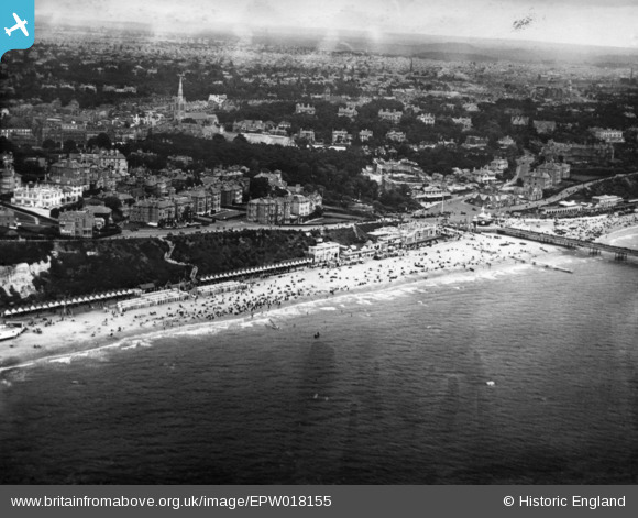
EPW018155 ENGLAND (1927). West Cliff Promenade and the town, Bournemouth, from the south, 1927. This image has been produced from a print.
© Copyright OpenStreetMap contributors and licensed by the OpenStreetMap Foundation. 2026. Cartography is licensed as CC BY-SA.
Nearby Images (20)
EPW018155

EAW049056

EPW018164

EAW050053

EPW000261

EPW013551

EPR000661

EPW000253

EPW018167

EPW037418

EPW000252

EPW041047

EAW002993

EPW013560

EPW041046

EPW013553

EPW000266

EAW018154

EAW034624

EPW013552

Details
| Title | [EPW018155] West Cliff Promenade and the town, Bournemouth, from the south, 1927. This image has been produced from a print. |
| Reference | EPW018155 |
| Date | 5-June-1927 |
| Link | |
| Place name | BOURNEMOUTH |
| Parish | |
| District | |
| Country | ENGLAND |
| Easting / Northing | 408730, 90548 |
| Longitude / Latitude | -1.8763341172343, 50.71392281414 |
| National Grid Reference | SZ087905 |
Pins
Be the first to add a comment to this image!