
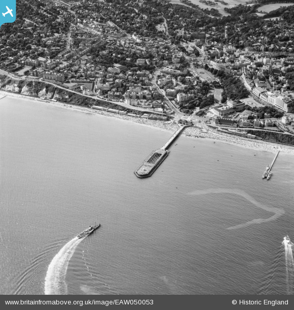
EAW050053 ENGLAND (1953). Bournemouth Pier and environs, Bournemouth, 1953
© Copyright OpenStreetMap contributors and licensed by the OpenStreetMap Foundation. 2026. Cartography is licensed as CC BY-SA.
Nearby Images (23)
EAW050053

EPW000261

EAW049056

EPW013551

EPR000661

EPW000252

EPW041047

EPW000253

EPW041046

EPW037418

EPW018164

EPW037422

EPW018167

EPW013553

EAW034624

EAW018154

EPW018155

EPW013560

EPW061510

EAW050052

EPW000266

EAW002993

EPW013552

Details
| Title | [EAW050053] Bournemouth Pier and environs, Bournemouth, 1953 |
| Reference | EAW050053 |
| Date | 18-June-1953 |
| Link | |
| Place name | BOURNEMOUTH |
| Parish | |
| District | |
| Country | ENGLAND |
| Easting / Northing | 408884, 90569 |
| Longitude / Latitude | -1.8741521112366, 50.714109347569 |
| National Grid Reference | SZ089906 |
Pins

Matt Aldred edob.mattaldred.com |
Sunday 14th of June 2026 05:53:20 PM | |

Class31 |
Saturday 17th of October 2015 11:17:33 PM | |

MB |
Saturday 7th of June 2014 01:50:56 PM | |
Probably PS "Consul" |
mannidaze |
Saturday 13th of September 2014 09:38:07 PM |
