
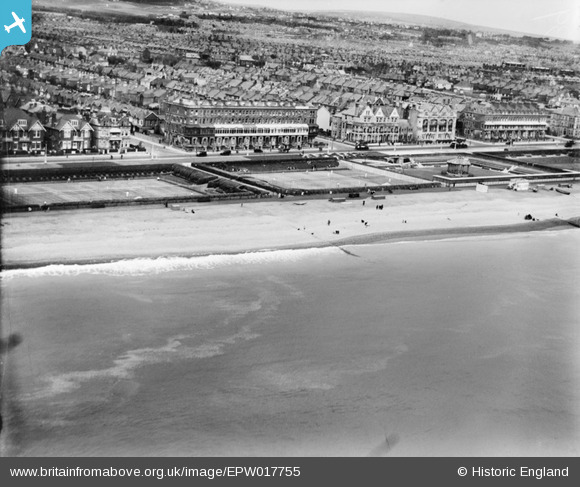
EPW017755 ENGLAND (1927). Western Lawns, Hove, 1927
© Copyright OpenStreetMap contributors and licensed by the OpenStreetMap Foundation. 2026. Cartography is licensed as CC BY-SA.
Nearby Images (5)
EPW017755

EPW045505

EPW018069

EPW018066

EPW039532

Details
| Title | [EPW017755] Western Lawns, Hove, 1927 |
| Reference | EPW017755 |
| Date | April-1927 |
| Link | |
| Place name | HOVE |
| Parish | |
| District | |
| Country | ENGLAND |
| Easting / Northing | 527624, 104415 |
| Longitude / Latitude | -0.18779422632504, 50.824629331249 |
| National Grid Reference | TQ276044 |
Pins
Be the first to add a comment to this image!