
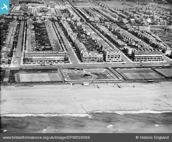
EPW018069 ENGLAND (1927). The band stand, Hove, from the south, 1927
© Copyright OpenStreetMap contributors and licensed by the OpenStreetMap Foundation. 2026. Cartography is licensed as CC BY-SA.
Nearby Images (3)
EPW018069

EPW045505

EPW017755

Details
| Title | [EPW018069] The band stand, Hove, from the south, 1927 |
| Reference | EPW018069 |
| Date | May-1927 |
| Link | |
| Place name | HOVE |
| Parish | |
| District | |
| Country | ENGLAND |
| Easting / Northing | 527756, 104444 |
| Longitude / Latitude | -0.18591078082832, 50.824860895053 |
| National Grid Reference | TQ278044 |
Pins
Be the first to add a comment to this image!