
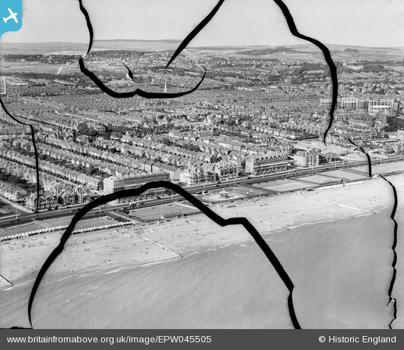
EPW045505 ENGLAND (1934). The beach, the bandstand and the town, Hove, from the south-west, 1934. This image has been produced from a damaged negative.
© Copyright OpenStreetMap contributors and licensed by the OpenStreetMap Foundation. 2026. Cartography is licensed as CC BY-SA.
Nearby Images (3)
EPW045505

EPW017755

EPW018069

Details
| Title | [EPW045505] The beach, the bandstand and the town, Hove, from the south-west, 1934. This image has been produced from a damaged negative. |
| Reference | EPW045505 |
| Date | July-1934 |
| Link | |
| Place name | HOVE |
| Parish | |
| District | |
| Country | ENGLAND |
| Easting / Northing | 527676, 104417 |
| Longitude / Latitude | -0.187055546947, 50.824635842109 |
| National Grid Reference | TQ277044 |
Pins
Be the first to add a comment to this image!