
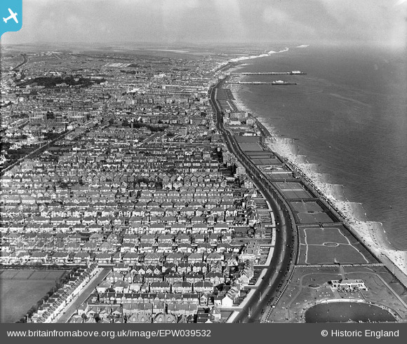
EPW039532 ENGLAND (1932). The Western Lawns, Kings Way and the town by the seafront, Hove, from the west, 1932
© Copyright OpenStreetMap contributors and licensed by the OpenStreetMap Foundation. 2026. Cartography is licensed as CC BY-SA.
Nearby Images (3)
EPW039532

EPW018066

EPW017755

Details
| Title | [EPW039532] The Western Lawns, Kings Way and the town by the seafront, Hove, from the west, 1932 |
| Reference | EPW039532 |
| Date | August-1932 |
| Link | |
| Place name | HOVE |
| Parish | |
| District | |
| Country | ENGLAND |
| Easting / Northing | 527402, 104660 |
| Longitude / Latitude | -0.19085971086902, 50.826880554239 |
| National Grid Reference | TQ274047 |
Pins

DJB |
Monday 1st of December 2014 07:24:27 PM | |

Alan McFaden |
Sunday 28th of July 2013 04:33:58 PM | |
|
Alan McFaden |
Sunday 28th of July 2013 04:32:43 PM | |
|
Alan McFaden |
Sunday 28th of July 2013 04:31:34 PM |


