
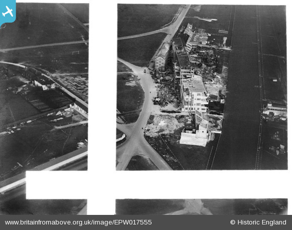
EPW017555 ENGLAND (1927). The Epsom racecourse grandstand under construction, Epsom Downs, 1927. This image was marked by Aerofilms Ltd for photo editing.
© Copyright OpenStreetMap contributors and licensed by the OpenStreetMap Foundation. 2026. Cartography is licensed as CC BY-SA.
Nearby Images (41)
EPW017555

EPW008703

EPW025157

EPW007651

EPW025150

EPW025156

EPW007902

EPW027456

EPW007652

EAW000990

EPW007650

EAW036444

EPW017556

EPW006394

EPW006482

EPW027522

EPW006485

EPW008665

EPW017557

EPW008671

EPW007901

EAW017624

EPW006484

EPW025158

EPW006431

EPW006380

EPW006444

EPW035515

EPW025144

EPW008663

EPW027458

EPW035522

EPW006369

EAW017626

EPW006365

EAW043436

EPW027457

EAW000991

EAW002165

EPW025147

EAW002167

Details
| Title | [EPW017555] The Epsom racecourse grandstand under construction, Epsom Downs, 1927. This image was marked by Aerofilms Ltd for photo editing. |
| Reference | EPW017555 |
| Date | May-1927 |
| Link | |
| Place name | EPSOM DOWNS |
| Parish | |
| District | |
| Country | ENGLAND |
| Easting / Northing | 521701, 158604 |
| Longitude / Latitude | -0.253614901712, 51.313011612748 |
| National Grid Reference | TQ217586 |
Pins
Be the first to add a comment to this image!