
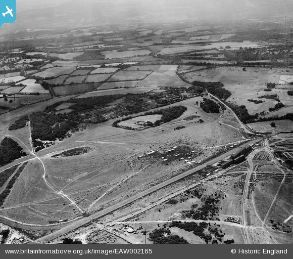
EAW002165 ENGLAND (1946). Epsom Downs, The City and Surburban Race Meeting, from the north-east, 1946
© Copyright OpenStreetMap contributors and licensed by the OpenStreetMap Foundation. 2026. Cartography is licensed as CC BY-SA.
Nearby Images (38)
EAW002165

EAW000991

EAW002167

EPW025147

EPW027457

EAW017627

EPW007653

EAW002166

EPW025144

EPW006391

EPW006431

EPW025158

EAW049499

EPW006380

EAW017626

EPW035515

EPW006387

EPW007900

EPW006369

EPW006382

EPW008663

EPW006364

EAW017624

EAW043433

EAW024759

EPW006482

EPW027459

EPW007650

EAW000990

EPW007902

EPW025156

EPW025150

EPW007652

EPW006441

EPW025140

EPW025157

EPW017555

EPW008703

Details
| Title | [EAW002165] Epsom Downs, The City and Surburban Race Meeting, from the north-east, 1946 |
| Reference | EAW002165 |
| Date | 5-August-1946 |
| Link | |
| Place name | EPSOM DOWNS |
| Parish | |
| District | |
| Country | ENGLAND |
| Easting / Northing | 521905, 158374 |
| Longitude / Latitude | -0.25076764204585, 51.310900557597 |
| National Grid Reference | TQ219584 |
Pins
Be the first to add a comment to this image!