
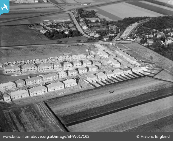
EPW017162 ENGLAND (1926). New housing at Francis Road, Hounslow, 1926
© Copyright OpenStreetMap contributors and licensed by the OpenStreetMap Foundation. 2026. Cartography is licensed as CC BY-SA.
Nearby Images (14)
EPW017162

EPW017168

EPW037332

EPW037296

EPW037518

EPW037334

EPW037517

EPW037519

EPW016528

EPW016527

EPW016529

EPW037294

EPW035079

EPW017161

Details
| Title | [EPW017162] New housing at Francis Road, Hounslow, 1926 |
| Reference | EPW017162 |
| Date | October-1926 |
| Link | |
| Place name | HOUNSLOW |
| Parish | |
| District | |
| Country | ENGLAND |
| Easting / Northing | 512030, 176048 |
| Longitude / Latitude | -0.38682386113353, 51.471804481932 |
| National Grid Reference | TQ120760 |
Pins

mariaud999 |
Wednesday 26th of December 2012 05:31:51 PM | |
|
mariaud999 |
Wednesday 26th of December 2012 05:31:13 PM | |
|
mariaud999 |
Wednesday 26th of December 2012 05:30:03 PM | |

Isleworth1961 |
Wednesday 15th of August 2012 05:20:45 PM | |
|
Isleworth1961 |
Wednesday 15th of August 2012 01:29:52 PM |