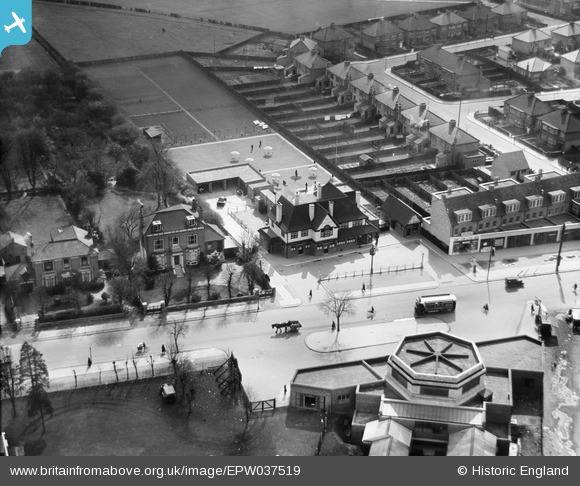
EPW037519 ENGLAND (1932). "The Earl Haigh" public house opposite Hounslow West Station, Hounslow, 1932
    © Copyright OpenStreetMap contributors and licensed by the OpenStreetMap Foundation. 2025. Cartography is licensed as CC BY-SA.
  
Nearby Images (16)
Details
| Title | [EPW037519] "The Earl Haigh" public house opposite Hounslow West Station, Hounslow, 1932 | 
| Reference | EPW037519 | 
| Date | May-1932 | 
| Link | |
| Place name | HOUNSLOW | 
| Parish | |
| District | |
| Country | ENGLAND | 
| Easting / Northing | 512193, 176084 | 
| Longitude / Latitude | -0.38446631225387, 51.472095780487 | 
| National Grid Reference | TQ122761 | 
Pins
|   Isleworth1961 | Monday 17th of December 2012 01:15:32 AM | 
User Comment Contributions
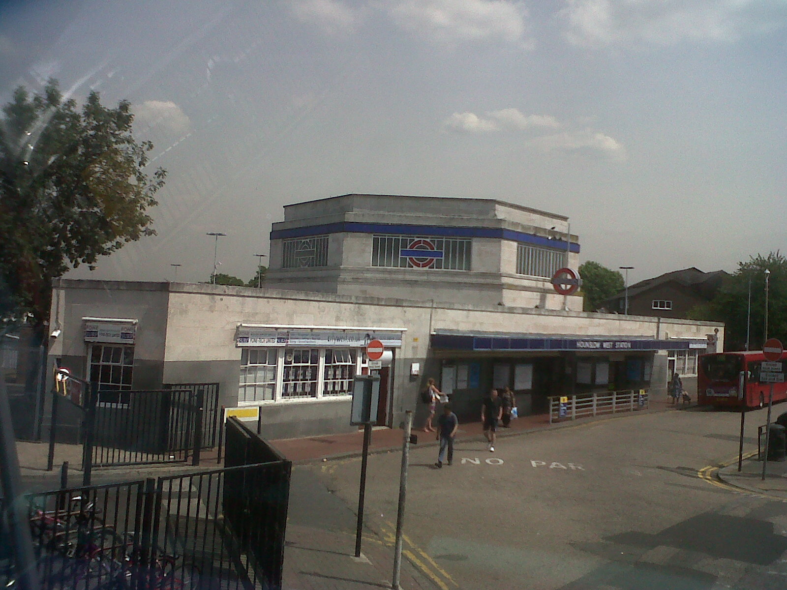
|   Hounslow West Underground Station. Photograph taken yesterday. | Class31 | Wednesday 17th of July 2013 09:50:45 AM | 
 
             
  ![[EPW037519] "The Earl Haigh" public house opposite Hounslow West Station, Hounslow, 1932](http://britainfromabove.org.uk/sites/all/libraries/aerofilms-images/public/100x100/EPW/037/EPW037519.jpg) 
 ![[EPW037334] The Earl Haig Pub off Bath Road, Hounslow West, 1932. This image has been produced from a copy-negative.](http://britainfromabove.org.uk/sites/all/libraries/aerofilms-images/public/100x100/EPW/037/EPW037334.jpg) 
 ![[EPW037517] "The Earl Haigh" public house opposite Hounslow West Station, Hounslow, 1932](http://britainfromabove.org.uk/sites/all/libraries/aerofilms-images/public/100x100/EPW/037/EPW037517.jpg) 
 ![[EPW037518] "The Earl Haigh" public house opposite Hounslow West Station, Hounslow, 1932](http://britainfromabove.org.uk/sites/all/libraries/aerofilms-images/public/100x100/EPW/037/EPW037518.jpg) 
 ![[EPW037296] Hounslow West Station, Bath Road and environs, Hounslow West, 1932. This image has been produced from a copy-negative.](http://britainfromabove.org.uk/sites/all/libraries/aerofilms-images/public/100x100/EPW/037/EPW037296.jpg) 
 ![[EPW016529] Bath Road and Hounslow West Station, Hounslow, 1926](http://britainfromabove.org.uk/sites/all/libraries/aerofilms-images/public/100x100/EPW/016/EPW016529.jpg) 
 ![[EPW016527] Bath Road, Hounslow, 1926](http://britainfromabove.org.uk/sites/all/libraries/aerofilms-images/public/100x100/EPW/016/EPW016527.jpg) 
 ![[EPW016528] Bath Road and Hounslow West Station, Hounslow, 1926](http://britainfromabove.org.uk/sites/all/libraries/aerofilms-images/public/100x100/EPW/016/EPW016528.jpg) 
 ![[EPW037332] Houses and gardens opposite Hounslow West Station, Hounslow, 1932](http://britainfromabove.org.uk/sites/all/libraries/aerofilms-images/public/100x100/EPW/037/EPW037332.jpg) 
 ![[EPW033774] Houses and St Paul's Church with Heston Air Park in the distance, Hounslow West, from the south-east, 1930. This image has been produced from a damaged negative](http://britainfromabove.org.uk/sites/all/libraries/aerofilms-images/public/100x100/EPW/033/EPW033774.jpg) 
 ![[EPW017168] New Housing at Francis Road, Hounslow, 1926](http://britainfromabove.org.uk/sites/all/libraries/aerofilms-images/public/100x100/EPW/017/EPW017168.jpg) 
 ![[EPW017162] New housing at Francis Road, Hounslow, 1926](http://britainfromabove.org.uk/sites/all/libraries/aerofilms-images/public/100x100/EPW/017/EPW017162.jpg) 
 ![[EPW037294] Looking over Heston, Hounslow West, from the south, 1932. This image has been produced from a copy-negative.](http://britainfromabove.org.uk/sites/all/libraries/aerofilms-images/public/100x100/EPW/037/EPW037294.jpg) 
 ![[EPW035079] Vicarage Farm, Hounslow West Station and environs, Hounslow West, 1931](http://britainfromabove.org.uk/sites/all/libraries/aerofilms-images/public/100x100/EPW/035/EPW035079.jpg) 
 ![[EPW035093] Residential development around Hounslow West Station, Hounslow West, 1931](http://britainfromabove.org.uk/sites/all/libraries/aerofilms-images/public/100x100/EPW/035/EPW035093.jpg) 
 ![[EPW033773] Heston Air Park and environs, Heston, from the south-east, 1930](http://britainfromabove.org.uk/sites/all/libraries/aerofilms-images/public/100x100/EPW/033/EPW033773.jpg)