
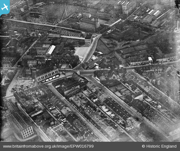
EPW016799 ENGLAND (1926). The town hall and environs, Elland, 1926
© Copyright OpenStreetMap contributors and licensed by the OpenStreetMap Foundation. 2025. Cartography is licensed as CC BY-SA.
Nearby Images (7)
EPW016799

EPW016798

EPW016800

EPW016801

EPW036860

EPW036862

EPW036861

Details
| Title | [EPW016799] The town hall and environs, Elland, 1926 |
| Reference | EPW016799 |
| Date | August-1926 |
| Link | |
| Place name | ELLAND |
| Parish | |
| District | |
| Country | ENGLAND |
| Easting / Northing | 411037, 420835 |
| Longitude / Latitude | -1.8328718751298, 53.68362798471 |
| National Grid Reference | SE110208 |
Pins
Be the first to add a comment to this image!