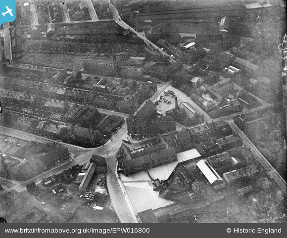
EPW016800 ENGLAND (1926). The town hall and environs, Elland, 1926
© Copyright OpenStreetMap contributors and licensed by the OpenStreetMap Foundation. 2025. Cartography is licensed as CC BY-SA.
Nearby Images (6)
Details
| Title | [EPW016800] The town hall and environs, Elland, 1926 |
| Reference | EPW016800 |
| Date | August-1926 |
| Link | |
| Place name | ELLAND |
| Parish | |
| District | |
| Country | ENGLAND |
| Easting / Northing | 410986, 420885 |
| Longitude / Latitude | -1.8336423693601, 53.684078517071 |
| National Grid Reference | SE110209 |
Pins
Be the first to add a comment to this image!


![[EPW016800] The town hall and environs, Elland, 1926](http://britainfromabove.org.uk/sites/all/libraries/aerofilms-images/public/100x100/EPW/016/EPW016800.jpg)
![[EPW016801] The Market Place and environs, Elland, 1926](http://britainfromabove.org.uk/sites/all/libraries/aerofilms-images/public/100x100/EPW/016/EPW016801.jpg)
![[EPW016799] The town hall and environs, Elland, 1926](http://britainfromabove.org.uk/sites/all/libraries/aerofilms-images/public/100x100/EPW/016/EPW016799.jpg)
![[EPW016798] Catherine Street and environs, Elland, 1926](http://britainfromabove.org.uk/sites/all/libraries/aerofilms-images/public/100x100/EPW/016/EPW016798.jpg)
![[EPW036860] The town, Elland, 1931](http://britainfromabove.org.uk/sites/all/libraries/aerofilms-images/public/100x100/EPW/036/EPW036860.jpg)
![[EPW036862] Huddersfield Road and environs, Elland, 1931](http://britainfromabove.org.uk/sites/all/libraries/aerofilms-images/public/100x100/EPW/036/EPW036862.jpg)