
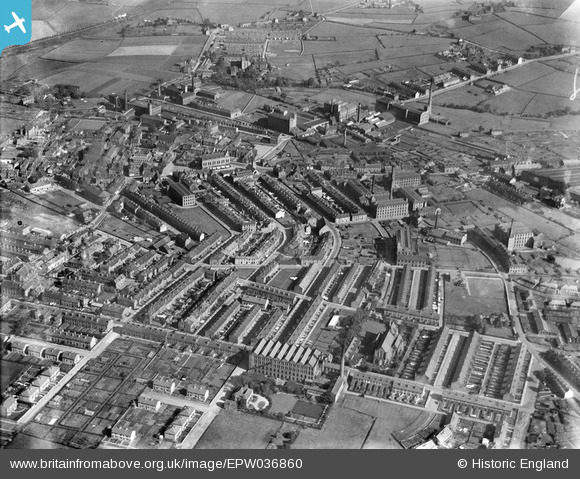
EPW036860 ENGLAND (1931). The town, Elland, 1931
© Copyright OpenStreetMap contributors and licensed by the OpenStreetMap Foundation. 2025. Cartography is licensed as CC BY-SA.
Nearby Images (6)
EPW036860

EPW016798

EPW016799

EPW016800

EPW016801

EPW036862

Details
| Title | [EPW036860] The town, Elland, 1931 |
| Reference | EPW036860 |
| Date | September-1931 |
| Link | |
| Place name | ELLAND |
| Parish | |
| District | |
| Country | ENGLAND |
| Easting / Northing | 410906, 420695 |
| Longitude / Latitude | -1.8348604609893, 53.682372255206 |
| National Grid Reference | SE109207 |
