
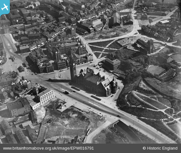
EPW016791 ENGLAND (1926). Town Hall Square, Rochdale, 1926
© Copyright OpenStreetMap contributors and licensed by the OpenStreetMap Foundation. 2026. Cartography is licensed as CC BY-SA.
Nearby Images (5)
EPW016791

EPW016783

EPW016786

EPW016797

EPW016780

Details
| Title | [EPW016791] Town Hall Square, Rochdale, 1926 |
| Reference | EPW016791 |
| Date | August-1926 |
| Link | |
| Place name | ROCHDALE |
| Parish | |
| District | |
| Country | ENGLAND |
| Easting / Northing | 389604, 413263 |
| Longitude / Latitude | -2.1571684849668, 53.615574894209 |
| National Grid Reference | SD896133 |
Pins

Mel |
Thursday 3rd of June 2021 02:58:48 PM | |
|
wadey |
Tuesday 16th of December 2014 03:20:10 PM | |
|
wadey |
Tuesday 16th of December 2014 03:19:44 PM | |
|
wadey |
Tuesday 16th of December 2014 03:19:07 PM | |
|
Mikeya |
Sunday 6th of April 2014 11:14:20 AM | |
|
Mikeya |
Sunday 6th of April 2014 11:13:27 AM | |
|
Mikeya |
Sunday 6th of April 2014 11:13:09 AM | |
|
Mikeya |
Sunday 6th of April 2014 11:12:30 AM | |
|
Mikeya |
Sunday 6th of April 2014 11:11:48 AM | |
|
Mikeya |
Sunday 6th of April 2014 11:11:24 AM | |
|
Mikeya |
Sunday 6th of April 2014 11:10:18 AM | |
|
Mikeya |
Sunday 6th of April 2014 11:09:41 AM | |
|
Mikeya |
Sunday 6th of April 2014 11:08:42 AM |