
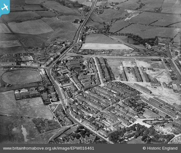
EPW016461 ENGLAND (1926). Fielding Street and environs, Middleton, 1926
© Copyright OpenStreetMap contributors and licensed by the OpenStreetMap Foundation. 2026. Cartography is licensed as CC BY-SA.
Nearby Images (5)
EPW016461

EPW016451

EPW016439

EPW016453

EPW016467

Details
| Title | [EPW016461] Fielding Street and environs, Middleton, 1926 |
| Reference | EPW016461 |
| Date | 6-August-1926 |
| Link | |
| Place name | MIDDLETON |
| Parish | |
| District | |
| Country | ENGLAND |
| Easting / Northing | 387252, 406697 |
| Longitude / Latitude | -2.1924578860113, 53.556499301669 |
| National Grid Reference | SD873067 |
Pins

howard2 |
Saturday 20th of October 2012 10:55:54 AM | |
|
howard2 |
Saturday 20th of October 2012 10:54:30 AM | |
|
Andy Marshall |
Wednesday 27th of June 2012 04:11:59 PM |