
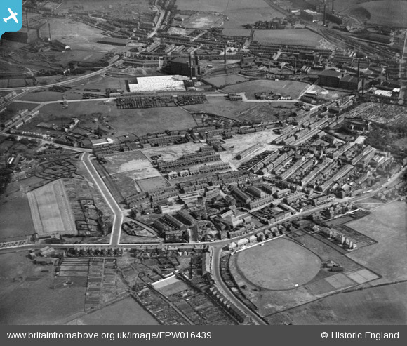
EPW016439 ENGLAND (1926). North Street and environs, Middleton, 1926
© Copyright OpenStreetMap contributors and licensed by the OpenStreetMap Foundation. 2026. Cartography is licensed as CC BY-SA.
Nearby Images (4)
EPW016439

EPW016451

EPW016461

EPW016453

Details
| Title | [EPW016439] North Street and environs, Middleton, 1926 |
| Reference | EPW016439 |
| Date | 6-August-1926 |
| Link | |
| Place name | MIDDLETON |
| Parish | |
| District | |
| Country | ENGLAND |
| Easting / Northing | 387355, 406594 |
| Longitude / Latitude | -2.190898726024, 53.555575892783 |
| National Grid Reference | SD874066 |
Pins

Sharples01 |
Wednesday 19th of January 2022 05:25:44 PM | |
|
Sharples01 |
Wednesday 19th of January 2022 05:23:59 PM | |
|
Eddie |
Tuesday 29th of March 2016 11:37:15 PM | |
|
Eddie |
Tuesday 29th of March 2016 11:31:21 PM | |
|
Eddie |
Tuesday 29th of March 2016 11:29:24 PM | |
|
Tom A |
Tuesday 17th of July 2012 04:29:07 PM | |
|
Andy Marshall |
Wednesday 27th of June 2012 04:08:43 PM |