
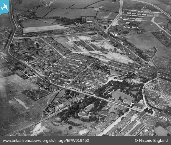
EPW016453 ENGLAND (1926). King Street and environs, Middleton, 1926
© Copyright OpenStreetMap contributors and licensed by the OpenStreetMap Foundation. 2026. Cartography is licensed as CC BY-SA.
Nearby Images (4)
EPW016453

EPW016451

EPW016439

EPW016461

Details
| Title | [EPW016453] King Street and environs, Middleton, 1926 |
| Reference | EPW016453 |
| Date | 6-August-1926 |
| Link | |
| Place name | MIDDLETON |
| Parish | |
| District | |
| Country | ENGLAND |
| Easting / Northing | 387186, 406483 |
| Longitude / Latitude | -2.1934455139733, 53.554573978443 |
| National Grid Reference | SD872065 |
Pins

Al Roach |
Tuesday 17th of July 2012 08:48:43 PM | |
|
Al Roach |
Tuesday 17th of July 2012 08:46:36 PM | |
|
Al Roach |
Tuesday 17th of July 2012 08:45:28 PM | |
|
Al Roach |
Tuesday 17th of July 2012 08:43:22 PM | |
|
Al Roach |
Tuesday 17th of July 2012 08:41:28 PM | |
|
Al Roach |
Tuesday 17th of July 2012 08:38:40 PM | |
|
howard2 |
Friday 29th of June 2012 06:27:02 PM | |
|
howard2 |
Friday 29th of June 2012 06:15:33 PM | |
|
howard2 |
Friday 29th of June 2012 06:10:56 PM | |
|
Paul Martin |
Wednesday 27th of June 2012 10:30:31 PM | |
|
Paul Martin |
Wednesday 27th of June 2012 10:29:32 PM | |
|
Andy Marshall |
Wednesday 27th of June 2012 04:01:45 PM | |
|
Andy Marshall |
Wednesday 27th of June 2012 04:01:14 PM | |
|
Andy Marshall |
Wednesday 27th of June 2012 03:59:52 PM | |
|
Andy Marshall |
Wednesday 27th of June 2012 03:57:02 PM |
User Comment Contributions
Mellalieu Street & the old rectory very visible |
howard2 |
Tuesday 5th of January 2016 05:42:07 PM |