
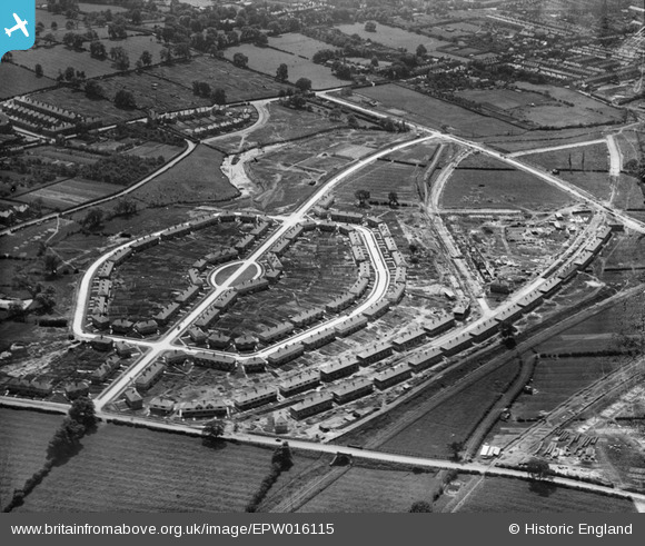
EPW016115 ENGLAND (1926). Housing estate around Alcuin Avenue, York, 1926
© Copyright OpenStreetMap contributors and licensed by the OpenStreetMap Foundation. 2026. Cartography is licensed as CC BY-SA.
Nearby Images (10)
EPW016115

EPW015712

EPW016076

EPW015711

EPW016079

EPW016078

EPW016077

EPW015710

EPW015709

EPW016111

Details
| Title | [EPW016115] Housing estate around Alcuin Avenue, York, 1926 |
| Reference | EPW016115 |
| Date | July-1926 |
| Link | |
| Place name | YORK |
| Parish | |
| District | |
| Country | ENGLAND |
| Easting / Northing | 462197, 451719 |
| Longitude / Latitude | -1.0520029547749, 53.957620175952 |
| National Grid Reference | SE622517 |
Pins

Wolfie |
Wednesday 29th of October 2025 07:46:34 AM | |
|
Wolfie |
Wednesday 29th of October 2025 07:45:12 AM | |
|
Wolfie |
Wednesday 29th of October 2025 07:44:19 AM | |
|
Wolfie |
Wednesday 29th of October 2025 07:43:44 AM | |
|
Wolfie |
Wednesday 29th of October 2025 07:42:35 AM | |
|
Wolfie |
Wednesday 29th of October 2025 07:42:18 AM | |
|
Wolfie |
Wednesday 29th of October 2025 07:41:40 AM | |
|
Wolfie |
Wednesday 29th of October 2025 07:40:13 AM | |

Ray Ban |
Thursday 29th of January 2015 11:09:53 PM | |
|
Ray Ban |
Thursday 29th of January 2015 11:06:38 PM | |
|
Ray Ban |
Thursday 29th of January 2015 11:00:32 PM | |
|
mpopka |
Sunday 21st of October 2012 07:28:15 AM | |
|
mpopka |
Sunday 21st of October 2012 07:27:38 AM | |
|
mpopka |
Sunday 21st of October 2012 07:26:49 AM |