
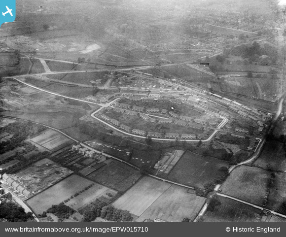
EPW015710 ENGLAND (1926). Housing estate around Alcuin Avenue, York, 1926
© Copyright OpenStreetMap contributors and licensed by the OpenStreetMap Foundation. 2026. Cartography is licensed as CC BY-SA.
Nearby Images (10)
EPW015710

EPW016078

EPW016079

EPW016077

EPW015711

EPW015712

EPW015709

EPW016115

EPW016111

EPW016076

Details
| Title | [EPW015710] Housing estate around Alcuin Avenue, York, 1926 |
| Reference | EPW015710 |
| Date | May-1926 |
| Link | |
| Place name | YORK |
| Parish | |
| District | |
| Country | ENGLAND |
| Easting / Northing | 462225, 451675 |
| Longitude / Latitude | -1.0515852231784, 53.95722135635 |
| National Grid Reference | SE622517 |
