
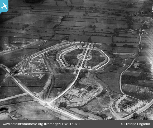
EPW016079 ENGLAND (1926). Housing estate aound Alcuin Avenue, York, 1926
© Copyright OpenStreetMap contributors and licensed by the OpenStreetMap Foundation. 2026. Cartography is licensed as CC BY-SA.
Nearby Images (10)
EPW016079

EPW015710

EPW016078

EPW015711

EPW015712

EPW016077

EPW016115

EPW015709

EPW016076

EPW016111

Details
| Title | [EPW016079] Housing estate aound Alcuin Avenue, York, 1926 |
| Reference | EPW016079 |
| Date | 30-June-1926 |
| Link | |
| Place name | YORK |
| Parish | |
| District | |
| Country | ENGLAND |
| Easting / Northing | 462211, 451683 |
| Longitude / Latitude | -1.0517969431996, 53.957294940745 |
| National Grid Reference | SE622517 |
Pins

Ray Ban |
Friday 30th of January 2015 08:01:08 PM | |
|
Ray Ban |
Friday 30th of January 2015 07:56:41 PM | |
|
Gavin Thomas |
Monday 16th of July 2012 05:46:10 PM | |
Local tennis club? |
John Wass |
Friday 22nd of August 2014 10:12:17 AM |
|
Gavin Thomas |
Monday 16th of July 2012 05:44:55 PM |