
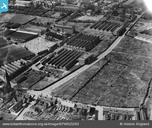
EPW015263 ENGLAND (1926). The Villiers Engineering Co Ltd Works, Wolverhampton, 1926
© Copyright OpenStreetMap contributors and licensed by the OpenStreetMap Foundation. 2026. Cartography is licensed as CC BY-SA.
Nearby Images (18)
EPW015263

EPW050147

EPW050140

EPW015262

EPW015260

EPW008127

EPW049917

EPW008123

EPW015261

EPW050146

EPW050143

EPW008121

EPW008122

EPW050142

EPW050148

EPW050141

EPW050144

EPW050145

Details
| Title | [EPW015263] The Villiers Engineering Co Ltd Works, Wolverhampton, 1926 |
| Reference | EPW015263 |
| Date | April-1926 |
| Link | |
| Place name | WOLVERHAMPTON |
| Parish | |
| District | |
| Country | ENGLAND |
| Easting / Northing | 391186, 297284 |
| Longitude / Latitude | -2.1300688204331, 52.572946714856 |
| National Grid Reference | SO912973 |
