
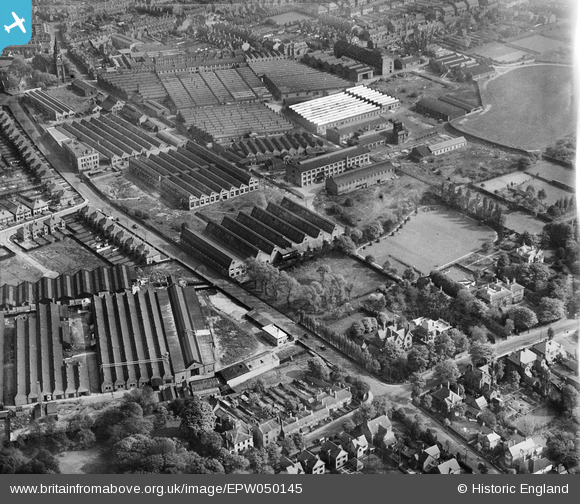
EPW050145 ENGLAND (1936). The Villiers Engineering Works, Marston Road and environs, Blakenhall, 1936
© Copyright OpenStreetMap contributors and licensed by the OpenStreetMap Foundation. 2026. Cartography is licensed as CC BY-SA.
Nearby Images (21)
EPW050145

EPW050148

EPW050142

EPW050141

EPW050146

EPW050144

EPW008121

EPW050143

EAW038035

EAW038036

EAW038037

EAW038038

EPW049917

EAW038034

EPW008123

EPW015263

EPW008127

EPW050147

EPW050140

EPW015262

EPW015260

Details
| Title | [EPW050145] The Villiers Engineering Works, Marston Road and environs, Blakenhall, 1936 |
| Reference | EPW050145 |
| Date | May-1936 |
| Link | |
| Place name | BLAKENHALL |
| Parish | |
| District | |
| Country | ENGLAND |
| Easting / Northing | 390965, 297365 |
| Longitude / Latitude | -2.1333323325233, 52.573671346014 |
| National Grid Reference | SO910974 |
