
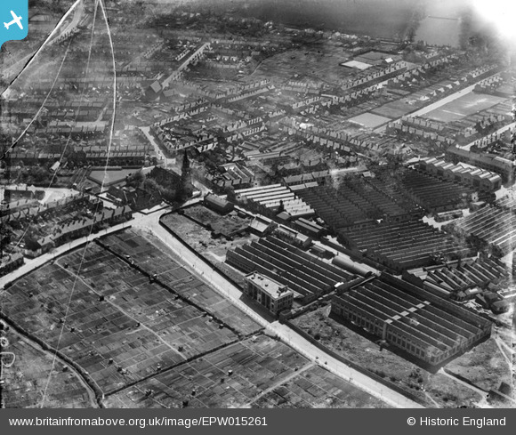
EPW015261 ENGLAND (1926). The Villiers Engineering Co Ltd Works, Wolverhampton, 1926
© Copyright OpenStreetMap contributors and licensed by the OpenStreetMap Foundation. 2026. Cartography is licensed as CC BY-SA.
Nearby Images (16)
EPW015261

EPW015260

EPW008122

EPW015262

EPW008127

EPW050140

EPW015263

EPW050147

EPW008123

EPW049917

EPW008121

EPW050146

EPW050143

EPW050142

EPW050148

EPW050141

Details
| Title | [EPW015261] The Villiers Engineering Co Ltd Works, Wolverhampton, 1926 |
| Reference | EPW015261 |
| Date | April-1926 |
| Link | |
| Place name | WOLVERHAMPTON |
| Parish | |
| District | |
| Country | ENGLAND |
| Easting / Northing | 391226, 297187 |
| Longitude / Latitude | -2.129475970478, 52.572075249875 |
| National Grid Reference | SO912972 |
Pins

David |
Friday 9th of January 2015 07:17:33 PM |