
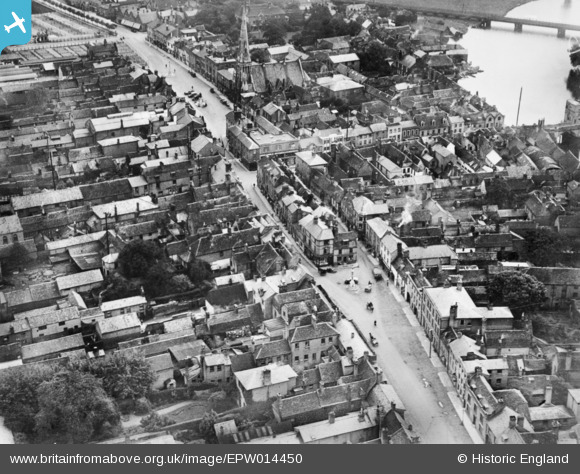
EPW014450 ENGLAND (1925). The town centre, St Ives, 1925. This image has been produced from a copy-negative.
© Copyright OpenStreetMap contributors and licensed by the OpenStreetMap Foundation. 2026. Cartography is licensed as CC BY-SA.
Nearby Images (14)
EPW014450

EPW028946

EPW028944

EPW014452

EPW028939

EAW031904

EPW028942

EPW014453

EPW028943

EAW031905

EPW028945

EPW028940

EPW014456

EPW028941

Details
| Title | [EPW014450] The town centre, St Ives, 1925. This image has been produced from a copy-negative. |
| Reference | EPW014450 |
| Date | 9-October-1925 |
| Link | |
| Place name | ST IVES |
| Parish | SAINT IVES |
| District | |
| Country | ENGLAND |
| Easting / Northing | 531298, 271309 |
| Longitude / Latitude | -0.073238371651783, 52.323762644644 |
| National Grid Reference | TL313713 |
Pins
Be the first to add a comment to this image!