
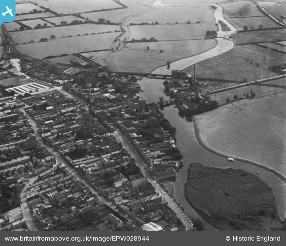
EPW028944 ENGLAND (1929). The town, St Ives, 1929. This image has been produced from a print.
© Copyright OpenStreetMap contributors and licensed by the OpenStreetMap Foundation. 2026. Cartography is licensed as CC BY-SA.
Nearby Images (13)
EPW028944

EPW028939

EPW014452

EPW014450

EPW028946

EPW028942

EPW028943

EAW031904

EAW031905

EPW014453

EPW028940

EPW028945

EPW014456

Details
| Title | [EPW028944] The town, St Ives, 1929. This image has been produced from a print. |
| Reference | EPW028944 |
| Date | September-1929 |
| Link | |
| Place name | ST IVES |
| Parish | SAINT IVES |
| District | |
| Country | ENGLAND |
| Easting / Northing | 531251, 271257 |
| Longitude / Latitude | -0.07394795875063, 52.323306607757 |
| National Grid Reference | TL313713 |
Pins
Be the first to add a comment to this image!