
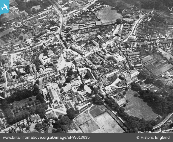
EPW013635 ENGLAND (1925). The town centre, Romsey, 1925. This image has been produced from a copy-negative.
© Copyright OpenStreetMap contributors and licensed by the OpenStreetMap Foundation. 2026. Cartography is licensed as CC BY-SA.
Nearby Images (21)
EPW013635

EPW032327

EPW013640

EPW032325

EAW034102

EPW013638

EAW034103

EAW034105

EPW013641

EPW032328

EAW034106

EAW034099

EAW034100

EPW013636

EAW034101

EPW013639

EPW032326

EPW056976

EAW034098

EAW034097

EAW034104

Details
| Title | [EPW013635] The town centre, Romsey, 1925. This image has been produced from a copy-negative. |
| Reference | EPW013635 |
| Date | June-1925 |
| Link | |
| Place name | ROMSEY |
| Parish | ROMSEY |
| District | |
| Country | ENGLAND |
| Easting / Northing | 435160, 121144 |
| Longitude / Latitude | -1.4990072947834, 50.988079513885 |
| National Grid Reference | SU352211 |
Pins
Be the first to add a comment to this image!