
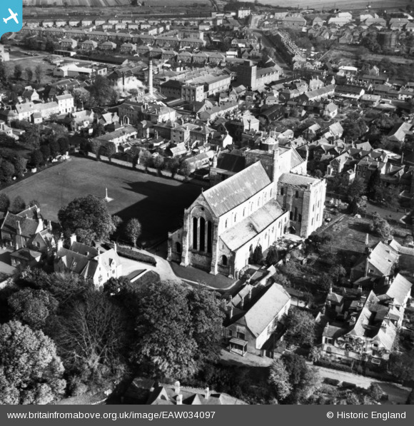
EAW034097 ENGLAND (1950). The Abbey Church of St Mary and St Ethelflaeda, Romsey, 1950. This image has been produced from a print.
© Copyright OpenStreetMap contributors and licensed by the OpenStreetMap Foundation. 2026. Cartography is licensed as CC BY-SA.
Nearby Images (22)
EAW034097

EPW032326

EPW013636

EPW013639

EAW034101

EAW034098

EAW034100

EAW034099

EAW034106

EAW034103

EAW034104

EAW034105

EPW013640

EPW032327

EAW034102

EPW032325

EPW013635

EPW013638

EPW032328

EPW013641

EPW056976

EPW033733

Details
| Title | [EAW034097] The Abbey Church of St Mary and St Ethelflaeda, Romsey, 1950. This image has been produced from a print. |
| Reference | EAW034097 |
| Date | 25-October-1950 |
| Link | |
| Place name | ROMSEY |
| Parish | ROMSEY |
| District | |
| Country | ENGLAND |
| Easting / Northing | 435054, 121253 |
| Longitude / Latitude | -1.5005071002258, 50.989066212679 |
| National Grid Reference | SU351213 |
Pins
Be the first to add a comment to this image!