
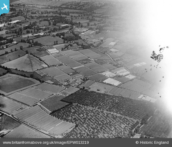
EPW013219 ENGLAND (1925). Glasshouses and orchards, Flamstead End, 1925
© Copyright OpenStreetMap contributors and licensed by the OpenStreetMap Foundation. 2025. Cartography is licensed as CC BY-SA.
Nearby Images (7)
EPW013219

EPW013218

EAW007159

EPW013217

EAW014154

EAW007161

EAW014153

Details
| Title | [EPW013219] Glasshouses and orchards, Flamstead End, 1925 |
| Reference | EPW013219 |
| Date | July-1925 |
| Link | |
| Place name | FLAMSTEAD END |
| Parish | |
| District | |
| Country | ENGLAND |
| Easting / Northing | 534103, 203598 |
| Longitude / Latitude | -0.058632364280953, 51.714601116239 |
| National Grid Reference | TL341036 |
Pins
Be the first to add a comment to this image!