
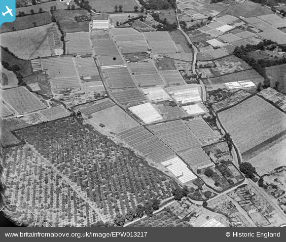
EPW013217 ENGLAND (1925). Glasshouses and orchards, Flamstead End, 1925
© Copyright OpenStreetMap contributors and licensed by the OpenStreetMap Foundation. 2025. Cartography is licensed as CC BY-SA.
Nearby Images (7)
EPW013217

EAW007159

EAW014153

EAW014154

EAW007164

EPW013219

EPW013218

Details
| Title | [EPW013217] Glasshouses and orchards, Flamstead End, 1925 |
| Reference | EPW013217 |
| Date | July-1925 |
| Link | |
| Place name | FLAMSTEAD END |
| Parish | |
| District | |
| Country | ENGLAND |
| Easting / Northing | 534246, 203513 |
| Longitude / Latitude | -0.056596234050908, 51.713803010014 |
| National Grid Reference | TL342035 |
Pins
Be the first to add a comment to this image!