
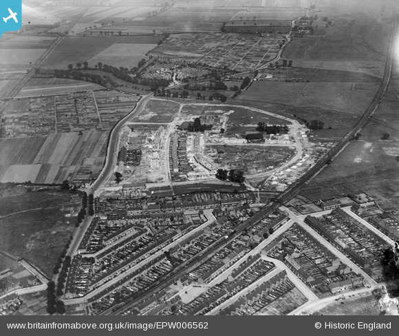
EPW006562 ENGLAND (1921). A new housing estate under construction at Eastbury Manor, Barking, 1921
© Copyright OpenStreetMap contributors and licensed by the OpenStreetMap Foundation. 2025. Cartography is licensed as CC BY-SA.
Nearby Images (6)
EPW006562

EPW006560

EPW006561

EPW006563

EPW036601

EPW036597

Details
| Title | [EPW006562] A new housing estate under construction at Eastbury Manor, Barking, 1921 |
| Reference | EPW006562 |
| Date | 7-June-1921 |
| Link | |
| Place name | BARKING |
| Parish | |
| District | |
| Country | ENGLAND |
| Easting / Northing | 545524, 183793 |
| Longitude / Latitude | 0.098361286486171, 51.533781256284 |
| National Grid Reference | TQ455838 |
Pins

GeoffBrown |
Wednesday 11th of February 2015 10:37:35 AM | |
|
BigglesH |
Friday 13th of July 2012 03:18:18 AM | |
|
steve _b |
Tuesday 3rd of July 2012 10:26:26 PM | |
|
Chelsea61 |
Friday 29th of June 2012 05:59:56 PM | |
|
Chelsea61 |
Friday 29th of June 2012 05:57:27 PM |