
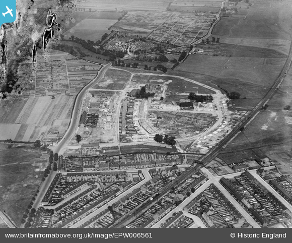
EPW006561 ENGLAND (1921). A new housing estate under construction at Eastbury Manor, Barking, 1921
© Copyright OpenStreetMap contributors and licensed by the OpenStreetMap Foundation. 2025. Cartography is licensed as CC BY-SA.
Nearby Images (5)
EPW006561

EPW006563

EPW006560

EPW006562

EPW036601

Details
| Title | [EPW006561] A new housing estate under construction at Eastbury Manor, Barking, 1921 |
| Reference | EPW006561 |
| Date | 7-June-1921 |
| Link | |
| Place name | BARKING |
| Parish | |
| District | |
| Country | ENGLAND |
| Easting / Northing | 545570, 183786 |
| Longitude / Latitude | 0.099021203233882, 51.533706490592 |
| National Grid Reference | TQ456838 |
Pins
User Comment Contributions
Just out of the picture (bottom left) would have been a level crossing on Ripple Road, which I know caused deaths and havoc over the years. (There's now a 1970s [I think] bridge.) |

BigglesH |
Friday 13th of July 2012 03:40:18 AM |