
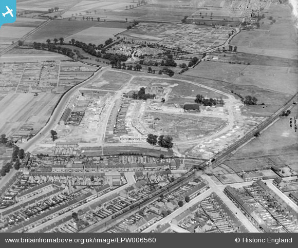
EPW006560 ENGLAND (1921). A new housing estate under construction at Eastbury Manor, Barking, 1921
© Copyright OpenStreetMap contributors and licensed by the OpenStreetMap Foundation. 2025. Cartography is licensed as CC BY-SA.
Nearby Images (5)
EPW006560

EPW006563

EPW006561

EPW006562

EPW036601

Details
| Title | [EPW006560] A new housing estate under construction at Eastbury Manor, Barking, 1921 |
| Reference | EPW006560 |
| Date | 7-June-1921 |
| Link | |
| Place name | BARKING |
| Parish | |
| District | |
| Country | ENGLAND |
| Easting / Northing | 545556, 183766 |
| Longitude / Latitude | 0.098811209392948, 51.533530372448 |
| National Grid Reference | TQ456838 |
Pins

GeoffBrown |
Wednesday 11th of February 2015 10:41:56 AM | |
|
GeoffBrown |
Wednesday 11th of February 2015 10:41:13 AM | |
|
BigglesH |
Friday 13th of July 2012 03:32:12 AM | |
|
BigglesH |
Friday 13th of July 2012 03:25:17 AM | |
|
BigglesH |
Friday 13th of July 2012 03:22:51 AM | |
|
Chelsea61 |
Friday 29th of June 2012 06:07:12 PM | |
|
Chelsea61 |
Friday 29th of June 2012 06:06:37 PM |