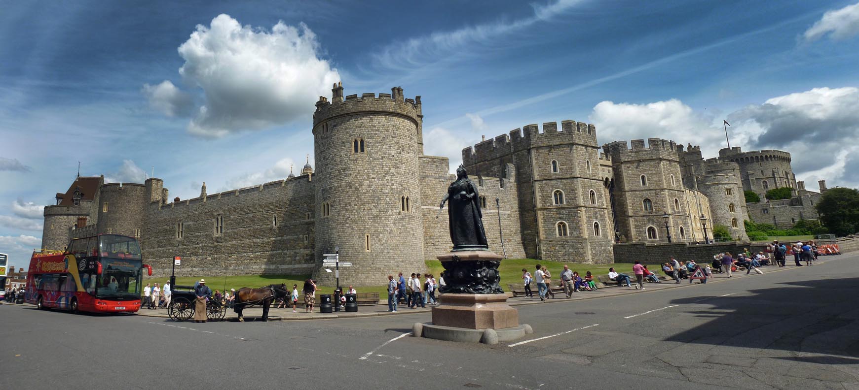
EPW005694 ENGLAND (1921). Windsor Castle, Windsor, 1921. This image has been produced from a copy-negative.
© Copyright OpenStreetMap contributors and licensed by the OpenStreetMap Foundation. 2026. Cartography is licensed as CC BY-SA.
Nearby Images (44)
Details
| Title | [EPW005694] Windsor Castle, Windsor, 1921. This image has been produced from a copy-negative. |
| Reference | EPW005694 |
| Date | March-1921 |
| Link | |
| Place name | WINDSOR |
| Parish | |
| District | |
| Country | ENGLAND |
| Easting / Northing | 496964, 177046 |
| Longitude / Latitude | -0.60341805799754, 51.483559627116 |
| National Grid Reference | SU970770 |
Pins
Be the first to add a comment to this image!
User Comment Contributions

Windsor Castle |

Alan McFaden |
Friday 14th of November 2014 11:04:29 AM |


![[EPW005694] Windsor Castle, Windsor, 1921. This image has been produced from a copy-negative.](http://britainfromabove.org.uk/sites/all/libraries/aerofilms-images/public/100x100/EPW/005/EPW005694.jpg)
![[EPW053885] Windsor Castle, Windsor, 1937](http://britainfromabove.org.uk/sites/all/libraries/aerofilms-images/public/100x100/EPW/053/EPW053885.jpg)
![[EAW003663] Flooding at Windsor and Eton, Windsor, from the south-east, 1947](http://britainfromabove.org.uk/sites/all/libraries/aerofilms-images/public/100x100/EAW/003/EAW003663.jpg)
![[EPW005691] Windsor Castle, Windsor, 1921](http://britainfromabove.org.uk/sites/all/libraries/aerofilms-images/public/100x100/EPW/005/EPW005691.jpg)
![[EPW034874] Windsor Castle, Windsor, 1931](http://britainfromabove.org.uk/sites/all/libraries/aerofilms-images/public/100x100/EPW/034/EPW034874.jpg)
![[EPW034876] Windsor Castle and the railway station, Windsor, 1931](http://britainfromabove.org.uk/sites/all/libraries/aerofilms-images/public/100x100/EPW/034/EPW034876.jpg)
![[EAW004843] Windsor Castle, Windsor, 1947](http://britainfromabove.org.uk/sites/all/libraries/aerofilms-images/public/100x100/EAW/004/EAW004843.jpg)
![[EPW056592] Windsor Castle, Windsor, 1938. This image has been produced from a copy-negative.](http://britainfromabove.org.uk/sites/all/libraries/aerofilms-images/public/100x100/EPW/056/EPW056592.jpg)
![[EPW012471] Windsor Castle, Windsor, 1925. This image has been produced from a print.](http://britainfromabove.org.uk/sites/all/libraries/aerofilms-images/public/100x100/EPW/012/EPW012471.jpg)
![[EAW052997] Windsor Castle, Windsor, 1953](http://britainfromabove.org.uk/sites/all/libraries/aerofilms-images/public/100x100/EAW/052/EAW052997.jpg)
![[EAW053000] Windsor Castle, Windsor, 1953](http://britainfromabove.org.uk/sites/all/libraries/aerofilms-images/public/100x100/EAW/053/EAW053000.jpg)
![[EAW004842] Windsor Castle and St George's Chapel, Windsor, 1947](http://britainfromabove.org.uk/sites/all/libraries/aerofilms-images/public/100x100/EAW/004/EAW004842.jpg)
![[EPW046521] Windsor Castle and the town, Windsor, 1935](http://britainfromabove.org.uk/sites/all/libraries/aerofilms-images/public/100x100/EPW/046/EPW046521.jpg)
![[EAW026474] Windsor Castle, Windsor, 1949](http://britainfromabove.org.uk/sites/all/libraries/aerofilms-images/public/100x100/EAW/026/EAW026474.jpg)
![[EPW056591] The Castle, Windsor, 1938](http://britainfromabove.org.uk/sites/all/libraries/aerofilms-images/public/100x100/EPW/056/EPW056591.jpg)
![[EAW004840] Windsor Castle and the East Terrace Garden, Windsor, 1947](http://britainfromabove.org.uk/sites/all/libraries/aerofilms-images/public/100x100/EAW/004/EAW004840.jpg)
![[EAW042132] Windsor Castle and the town in the snow, Windsor, from the north-west, 1952](http://britainfromabove.org.uk/sites/all/libraries/aerofilms-images/public/100x100/EAW/042/EAW042132.jpg)
![[EAW004841] Windsor Castle and St George's Chapel, Windsor, 1947](http://britainfromabove.org.uk/sites/all/libraries/aerofilms-images/public/100x100/EAW/004/EAW004841.jpg)
![[EPW053887] Windsor Castle and the town, Windsor, from the north-east, 1937](http://britainfromabove.org.uk/sites/all/libraries/aerofilms-images/public/100x100/EPW/053/EPW053887.jpg)
![[EPW046520] Windsor Castle, the East Terrace Garden and the town, Windsor, 1935](http://britainfromabove.org.uk/sites/all/libraries/aerofilms-images/public/100x100/EPW/046/EPW046520.jpg)
![[EPW046517] Windsor Castle, The Long Walk and the town, Windsor, 1935](http://britainfromabove.org.uk/sites/all/libraries/aerofilms-images/public/100x100/EPW/046/EPW046517.jpg)
![[EPW053886] Windsor Castle and the town, Windsor, from the north-east, 1937](http://britainfromabove.org.uk/sites/all/libraries/aerofilms-images/public/100x100/EPW/053/EPW053886.jpg)
![[EPW034873] Windsor Castle and the East Terrace Garden, Windsor, 1931](http://britainfromabove.org.uk/sites/all/libraries/aerofilms-images/public/100x100/EPW/034/EPW034873.jpg)
![[EPR000457] Windsor Castle and the town, Windsor, 1935](http://britainfromabove.org.uk/sites/all/libraries/aerofilms-images/public/100x100/EPR/000/EPR000457.jpg)
![[EPW022599] Windsor Castle and The Long Walk, Windsor, 1928](http://britainfromabove.org.uk/sites/all/libraries/aerofilms-images/public/100x100/EPW/022/EPW022599.jpg)
![[EPW012469] Windsor Castle, Windsor, 1925. This image has been produced from a print.](http://britainfromabove.org.uk/sites/all/libraries/aerofilms-images/public/100x100/EPW/012/EPW012469.jpg)
![[EPW046519] Windsor Castle, The Home Park and the town, Windsor, 1935](http://britainfromabove.org.uk/sites/all/libraries/aerofilms-images/public/100x100/EPW/046/EPW046519.jpg)
![[EPW046522] Windsor Castle, the East Terrace Garden and the town, Windsor, 1935](http://britainfromabove.org.uk/sites/all/libraries/aerofilms-images/public/100x100/EPW/046/EPW046522.jpg)
![[EPW022598] Windsor Castle Upper Ward and The Round Tower, Windsor, 1928](http://britainfromabove.org.uk/sites/all/libraries/aerofilms-images/public/100x100/EPW/022/EPW022598.jpg)
![[EAW021007] The castle and environs, Windsor, from the south, 1949. This image has been produced from a damaged negative.](http://britainfromabove.org.uk/sites/all/libraries/aerofilms-images/public/100x100/EAW/021/EAW021007.jpg)
![[EPW005692] General view of the town and Windsor Castle towards Eton, Windsor, from the south, 1921](http://britainfromabove.org.uk/sites/all/libraries/aerofilms-images/public/100x100/EPW/005/EPW005692.jpg)
![[EPW022601] Windsor Castle and East Terrace Garden, Windsor, 1928](http://britainfromabove.org.uk/sites/all/libraries/aerofilms-images/public/100x100/EPW/022/EPW022601.jpg)
![[EPW012468] Windsor Castle and the High Street, Windsor, 1925. This image has been produced from a print.](http://britainfromabove.org.uk/sites/all/libraries/aerofilms-images/public/100x100/EPW/012/EPW012468.jpg)
![[EAW004844] Windsor Castle, Windsor, from the south-west, 1947](http://britainfromabove.org.uk/sites/all/libraries/aerofilms-images/public/100x100/EAW/004/EAW004844.jpg)
![[EPW001600] Windsor Castle, Windsor, 1920. This image has been produced from a print.](http://britainfromabove.org.uk/sites/all/libraries/aerofilms-images/public/100x100/EPW/001/EPW001600.jpg)
![[EAW003662] Flooding at Windsor and Eton, Windsor, from the east, 1947](http://britainfromabove.org.uk/sites/all/libraries/aerofilms-images/public/100x100/EAW/003/EAW003662.jpg)
![[EPW022596] Windsor Castle and The Home Park, Windsor, from the west, 1928](http://britainfromabove.org.uk/sites/all/libraries/aerofilms-images/public/100x100/EPW/022/EPW022596.jpg)
![[EAW003704] Windsor Castle and the surrounding flooded area, Windsor, from the south, 1947](http://britainfromabove.org.uk/sites/all/libraries/aerofilms-images/public/100x100/EAW/003/EAW003704.jpg)
![[EPW022606] Bachelor's Acre and Windsor Castle, Windsor, 1928](http://britainfromabove.org.uk/sites/all/libraries/aerofilms-images/public/100x100/EPW/022/EPW022606.jpg)
![[EAW003781] Flooding at Windsor and Eton centred upon Windsor Castle, Windsor, from the south, 1947](http://britainfromabove.org.uk/sites/all/libraries/aerofilms-images/public/100x100/EAW/003/EAW003781.jpg)
![[EAW003703] Windsor Castle and the surrounding flooded area, Windsor, from the south, 1947](http://britainfromabove.org.uk/sites/all/libraries/aerofilms-images/public/100x100/EAW/003/EAW003703.jpg)
![[EPW047391] Windsor Castle, the town and surrounding countryside, Windsor, from the west, 1935](http://britainfromabove.org.uk/sites/all/libraries/aerofilms-images/public/100x100/EPW/047/EPW047391.jpg)
![[EPW005693] General view of the town and Windsor Castle, Windsor, from the south-east, 1921](http://britainfromabove.org.uk/sites/all/libraries/aerofilms-images/public/100x100/EPW/005/EPW005693.jpg)
![[EAW003705] Windsor Castle and the surrounding flooded area, Windsor, from the south-east, 1947](http://britainfromabove.org.uk/sites/all/libraries/aerofilms-images/public/100x100/EAW/003/EAW003705.jpg)