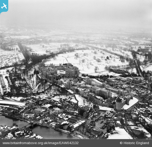
EAW042132 ENGLAND (1952). Windsor Castle and the town in the snow, Windsor, from the north-west, 1952
© Copyright OpenStreetMap contributors and licensed by the OpenStreetMap Foundation. 2026. Cartography is licensed as CC BY-SA.
Nearby Images (38)
EAW042132

EPW012471

EAW053000

EPW053885

EPW005694

EAW003663

EAW052997

EPW034876

EPW005691

EPW034874

EAW003662

EAW004841

EAW026474

EPW056592

EAW004843

EAW004842

EPW053887

EPW056591

EPW046521

EPR000457

EAW004840

EPW022596

EPW053886

EPW012469

EPW034873

EPW022599

EPW046520

EPW046517

EPW012468

EPW001600

EPW047391

EAW004844

EPW046522

EPW046519

EPW001599

EPW005692

EPW022598

EAW021007

Details
| Title | [EAW042132] Windsor Castle and the town in the snow, Windsor, from the north-west, 1952 |
| Reference | EAW042132 |
| Date | 31-March-1952 |
| Link | |
| Place name | WINDSOR |
| Parish | |
| District | |
| Country | ENGLAND |
| Easting / Northing | 496906, 177111 |
| Longitude / Latitude | -0.60423532859436, 51.484153911288 |
| National Grid Reference | SU969771 |
Pins

Alan McFaden |
Monday 9th of June 2014 10:12:11 AM |