
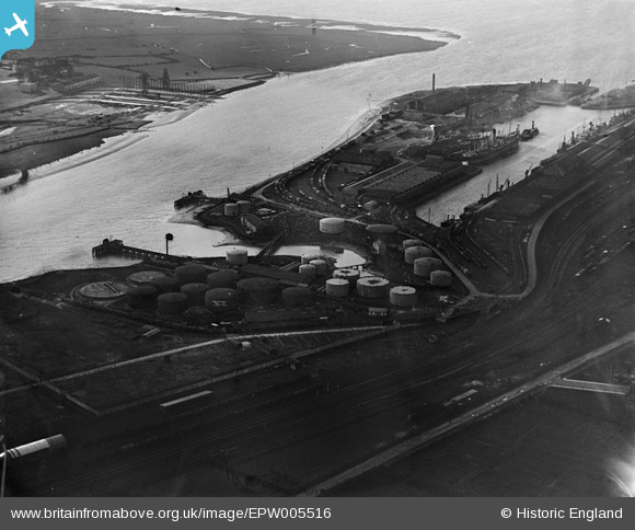
EPW005516 ENGLAND (1921). The Petroleum Storage Works, Avonmouth, 1921
© Copyright OpenStreetMap contributors and licensed by the OpenStreetMap Foundation. 2026. Cartography is licensed as CC BY-SA.
Nearby Images (16)
EPW005516

EPW046976

EPW046971

EPW046979

EPW046977

EPW046973

EPW046972

EPW046978

EPW011976

EPW046974

EPW005512

EPW005509

EPW046975

EPW019270

EAW002072

EPW027946

Details
| Title | [EPW005516] The Petroleum Storage Works, Avonmouth, 1921 |
| Reference | EPW005516 |
| Date | 20-March-1921 |
| Link | |
| Place name | AVONMOUTH |
| Parish | |
| District | |
| Country | ENGLAND |
| Easting / Northing | 351682, 177598 |
| Longitude / Latitude | -2.6960880363157, 51.494773524623 |
| National Grid Reference | ST517776 |
Pins

JKF |
Friday 6th of May 2016 10:12:53 AM | |
|
JKF |
Friday 6th of May 2016 10:12:48 AM |