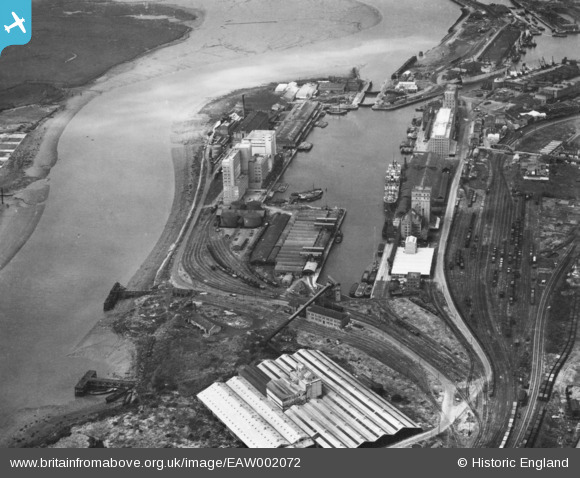
EAW002072 ENGLAND (1946). Avonmouth Docks, Avonmouth, 1946. This image has been produced from a print.
© Copyright OpenStreetMap contributors and licensed by the OpenStreetMap Foundation. 2026. Cartography is licensed as CC BY-SA.
Nearby Images (11)
Details
| Title | [EAW002072] Avonmouth Docks, Avonmouth, 1946. This image has been produced from a print. |
| Reference | EAW002072 |
| Date | 31-July-1946 |
| Link | |
| Place name | AVONMOUTH |
| Parish | |
| District | |
| Country | ENGLAND |
| Easting / Northing | 351458, 177730 |
| Longitude / Latitude | -2.6993329733765, 51.495941253429 |
| National Grid Reference | ST515777 |
Pins

redmist |
Tuesday 10th of November 2020 11:33:25 PM | |

redmist |
Tuesday 10th of November 2020 11:30:19 PM | |

redmist |
Tuesday 10th of November 2020 11:28:59 PM |


![[EAW002072] Avonmouth Docks, Avonmouth, 1946. This image has been produced from a print.](http://britainfromabove.org.uk/sites/all/libraries/aerofilms-images/public/100x100/EAW/002/EAW002072.jpg)
![[EPW046975] Avonmouth Dock, Cellactite and British Uralite Ltd and environs, Avonmouth, from the north-west, 1935](http://britainfromabove.org.uk/sites/all/libraries/aerofilms-images/public/100x100/EPW/046/EPW046975.jpg)
![[EAW002253] The Port of Bristol Authority Royal Edward Docks, Avonmouth, 1946. This image has been produced from a print.](http://britainfromabove.org.uk/sites/all/libraries/aerofilms-images/public/100x100/EAW/002/EAW002253.jpg)
![[EPW027946] Avonmouth Dock, Avonmouth, 1929](http://britainfromabove.org.uk/sites/all/libraries/aerofilms-images/public/100x100/EPW/027/EPW027946.jpg)
![[EPW019270] Avonmouth Dock, Avonmouth, 1927](http://britainfromabove.org.uk/sites/all/libraries/aerofilms-images/public/100x100/EPW/019/EPW019270.jpg)
![[EPR000060] The docks, Avonmouth, from the south, 1934. This image has been affected by flare.](http://britainfromabove.org.uk/sites/all/libraries/aerofilms-images/public/100x100/EPR/000/EPR000060.jpg)
![[EPR000061] The docks, Avonmouth, 1934. This image has been affected by flare.](http://britainfromabove.org.uk/sites/all/libraries/aerofilms-images/public/100x100/EPR/000/EPR000061.jpg)
![[EPW005516] The Petroleum Storage Works, Avonmouth, 1921](http://britainfromabove.org.uk/sites/all/libraries/aerofilms-images/public/100x100/EPW/005/EPW005516.jpg)
![[EPW027954] Avonmouth Dock, Avonmouth, 1929. This image has been produced from a print.](http://britainfromabove.org.uk/sites/all/libraries/aerofilms-images/public/100x100/EPW/027/EPW027954.jpg)
![[EPR000059] Flour Mills alongside Avonmouth Dock, Avonmouth, 1934](http://britainfromabove.org.uk/sites/all/libraries/aerofilms-images/public/100x100/EPR/000/EPR000059.jpg)
![[EPW027951] Avonmouth Dock and environs, Avonmouth, 1929](http://britainfromabove.org.uk/sites/all/libraries/aerofilms-images/public/100x100/EPW/027/EPW027951.jpg)