
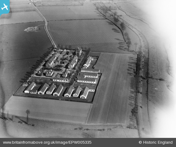
EPW005335 ENGLAND (1921). The Isolation Hospital, Dagenham, 1921
© Copyright OpenStreetMap contributors and licensed by the OpenStreetMap Foundation. 2025. Cartography is licensed as CC BY-SA.
Nearby Images (7)
EPW005335

EPW005332

EPW005337

EPW005334

EPW005331

EPW005336

EPW005333

Details
| Title | [EPW005335] The Isolation Hospital, Dagenham, 1921 |
| Reference | EPW005335 |
| Date | January-1921 |
| Link | |
| Place name | DAGENHAM |
| Parish | |
| District | |
| Country | ENGLAND |
| Easting / Northing | 550385, 183657 |
| Longitude / Latitude | 0.1683425155376, 51.531285087 |
| National Grid Reference | TQ504837 |
Pins
Be the first to add a comment to this image!
User Comment Contributions
Looks like the hospital was built in the middle of the countryside. All houses built there now. |

Buzzybee |
Monday 1st of February 2016 05:27:38 PM |