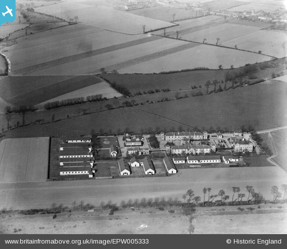
EPW005333 ENGLAND (1921). The Isolation Hospital, Dagenham, 1921
© Copyright OpenStreetMap contributors and licensed by the OpenStreetMap Foundation. 2025. Cartography is licensed as CC BY-SA.
Nearby Images (7)
Details
| Title | [EPW005333] The Isolation Hospital, Dagenham, 1921 |
| Reference | EPW005333 |
| Date | January-1921 |
| Link | |
| Place name | DAGENHAM |
| Parish | |
| District | |
| Country | ENGLAND |
| Easting / Northing | 550261, 183744 |
| Longitude / Latitude | 0.16659311228023, 51.53209988946 |
| National Grid Reference | TQ503837 |
Pins
Be the first to add a comment to this image!


![[EPW005333] The Isolation Hospital, Dagenham, 1921](http://britainfromabove.org.uk/sites/all/libraries/aerofilms-images/public/100x100/EPW/005/EPW005333.jpg)
![[EPW005331] The Isolation Hospital, Dagenham, 1921](http://britainfromabove.org.uk/sites/all/libraries/aerofilms-images/public/100x100/EPW/005/EPW005331.jpg)
![[EPW005336] The Isolation Hospital, Dagenham, 1921](http://britainfromabove.org.uk/sites/all/libraries/aerofilms-images/public/100x100/EPW/005/EPW005336.jpg)
![[EPW005334] The Isolation Hospital, Dagenham, 1921](http://britainfromabove.org.uk/sites/all/libraries/aerofilms-images/public/100x100/EPW/005/EPW005334.jpg)
![[EPW005337] The Isolation Hospital, Dagenham, 1921](http://britainfromabove.org.uk/sites/all/libraries/aerofilms-images/public/100x100/EPW/005/EPW005337.jpg)
![[EPW005335] The Isolation Hospital, Dagenham, 1921](http://britainfromabove.org.uk/sites/all/libraries/aerofilms-images/public/100x100/EPW/005/EPW005335.jpg)
![[EPW005332] The Isolation Hospital, Dagenham, 1921](http://britainfromabove.org.uk/sites/all/libraries/aerofilms-images/public/100x100/EPW/005/EPW005332.jpg)