
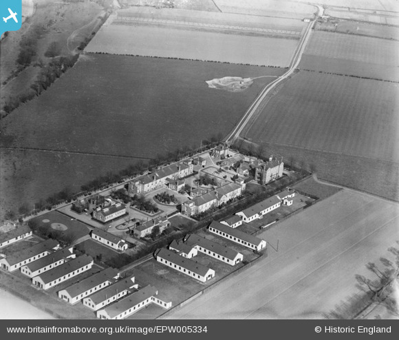
EPW005334 ENGLAND (1921). The Isolation Hospital, Dagenham, 1921
© Copyright OpenStreetMap contributors and licensed by the OpenStreetMap Foundation. 2025. Cartography is licensed as CC BY-SA.
Nearby Images (7)
EPW005334

EPW005331

EPW005336

EPW005335

EPW005333

EPW005337

EPW005332

Details
| Title | [EPW005334] The Isolation Hospital, Dagenham, 1921 |
| Reference | EPW005334 |
| Date | January-1921 |
| Link | |
| Place name | DAGENHAM |
| Parish | |
| District | |
| Country | ENGLAND |
| Easting / Northing | 550371, 183758 |
| Longitude / Latitude | 0.1681839452612, 51.532196403667 |
| National Grid Reference | TQ504838 |
Pins
Be the first to add a comment to this image!