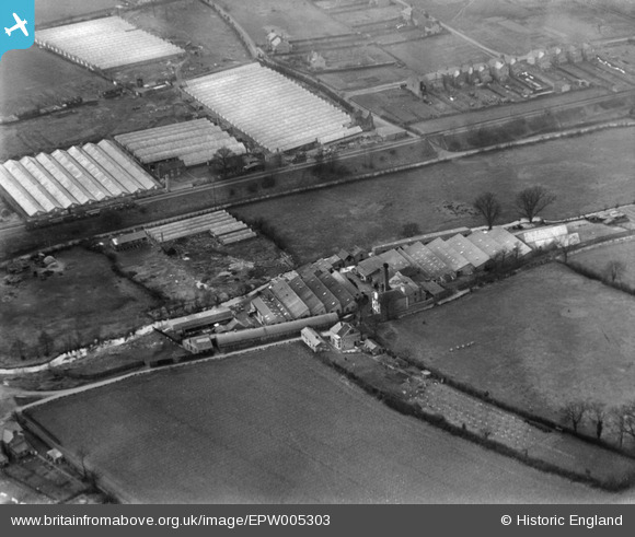
EPW005303 ENGLAND (1921). The Almagam Mills and Ox Lane Nursery, Harpenden, 1921
© Copyright OpenStreetMap contributors and licensed by the OpenStreetMap Foundation. 2026. Cartography is licensed as CC BY-SA.
Nearby Images (7)
Details
| Title | [EPW005303] The Almagam Mills and Ox Lane Nursery, Harpenden, 1921 |
| Reference | EPW005303 |
| Date | January-1921 |
| Link | |
| Place name | HARPENDEN |
| Parish | HARPENDEN |
| District | |
| Country | ENGLAND |
| Easting / Northing | 514254, 215445 |
| Longitude / Latitude | -0.34194141172964, 51.825481168614 |
| National Grid Reference | TL143154 |
Pins

John W |
Sunday 5th of March 2017 08:16:04 PM | |

John W |
Sunday 5th of March 2017 08:15:28 PM | |

John W |
Sunday 5th of March 2017 08:14:48 PM | |

John W |
Sunday 5th of March 2017 08:10:46 PM | |

John W |
Sunday 5th of March 2017 08:09:17 PM |


![[EPW005303] The Almagam Mills and Ox Lane Nursery, Harpenden, 1921](http://britainfromabove.org.uk/sites/all/libraries/aerofilms-images/public/100x100/EPW/005/EPW005303.jpg)
![[EPW005301] The Almagam Mills, Harpenden, 1921](http://britainfromabove.org.uk/sites/all/libraries/aerofilms-images/public/100x100/EPW/005/EPW005301.jpg)
![[EPW005300] The Almagam Mills, Harpenden, 1921](http://britainfromabove.org.uk/sites/all/libraries/aerofilms-images/public/100x100/EPW/005/EPW005300.jpg)
![[EPW005298] The Almagam Mills, Harpenden, 1921](http://britainfromabove.org.uk/sites/all/libraries/aerofilms-images/public/100x100/EPW/005/EPW005298.jpg)
![[EPW005299] The Almagam Mills, Harpenden, 1921](http://britainfromabove.org.uk/sites/all/libraries/aerofilms-images/public/100x100/EPW/005/EPW005299.jpg)
![[EAW047645] New housing surrounding Pickford Hill, Batford, 1952](http://britainfromabove.org.uk/sites/all/libraries/aerofilms-images/public/100x100/EAW/047/EAW047645.jpg)
![[EAW047648] New housing surrounding Pickford Hill, Batford, 1952](http://britainfromabove.org.uk/sites/all/libraries/aerofilms-images/public/100x100/EAW/047/EAW047648.jpg)