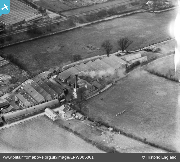
EPW005301 ENGLAND (1921). The Almagam Mills, Harpenden, 1921
    © Copyright OpenStreetMap contributors and licensed by the OpenStreetMap Foundation. 2025. Cartography is licensed as CC BY-SA.
  
Nearby Images (8)
Details
| Title | [EPW005301] The Almagam Mills, Harpenden, 1921 | 
| Reference | EPW005301 | 
| Date | January-1921 | 
| Link | |
| Place name | HARPENDEN | 
| Parish | HARPENDEN | 
| District | |
| Country | ENGLAND | 
| Easting / Northing | 514275, 215486 | 
| Longitude / Latitude | -0.34162326052194, 51.825845390706 | 
| National Grid Reference | TL143155 | 
Pins
Be the first to add a comment to this image!
 
             
  ![[EPW005301] The Almagam Mills, Harpenden, 1921](http://britainfromabove.org.uk/sites/all/libraries/aerofilms-images/public/100x100/EPW/005/EPW005301.jpg) 
  
                                          ![[EPW005298] The Almagam Mills, Harpenden, 1921](http://britainfromabove.org.uk/sites/all/libraries/aerofilms-images/public/100x100/EPW/005/EPW005298.jpg) 
 ![[EPW005300] The Almagam Mills, Harpenden, 1921](http://britainfromabove.org.uk/sites/all/libraries/aerofilms-images/public/100x100/EPW/005/EPW005300.jpg) 
 ![[EPW005303] The Almagam Mills and Ox Lane Nursery, Harpenden, 1921](http://britainfromabove.org.uk/sites/all/libraries/aerofilms-images/public/100x100/EPW/005/EPW005303.jpg) 
 ![[EPW005299] The Almagam Mills, Harpenden, 1921](http://britainfromabove.org.uk/sites/all/libraries/aerofilms-images/public/100x100/EPW/005/EPW005299.jpg) 
 ![[EAW047645] New housing surrounding Pickford Hill, Batford, 1952](http://britainfromabove.org.uk/sites/all/libraries/aerofilms-images/public/100x100/EAW/047/EAW047645.jpg) 
 ![[EAW047648] New housing surrounding Pickford Hill, Batford, 1952](http://britainfromabove.org.uk/sites/all/libraries/aerofilms-images/public/100x100/EAW/047/EAW047648.jpg) 
 ![[EAW047655] New housing surrounding Porters Hill and Noke Shot, Batford, 1952](http://britainfromabove.org.uk/sites/all/libraries/aerofilms-images/public/100x100/EAW/047/EAW047655.jpg)