
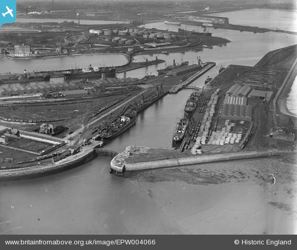
EPW004066 ENGLAND (1920). Dock Basin, Anchor Basin and Ramsden Dock, Barrow-in-Furness, 1920
© Copyright OpenStreetMap contributors and licensed by the OpenStreetMap Foundation. 2026. Cartography is licensed as CC BY-SA.
Nearby Images (7)
EPW004066

EPW007747

EPW007746

EPW007742

EPW007745

EPW007744

EPW007743

Details
| Title | [EPW004066] Dock Basin, Anchor Basin and Ramsden Dock, Barrow-in-Furness, 1920 |
| Reference | EPW004066 |
| Date | July-1920 |
| Link | |
| Place name | BARROW ISLAND |
| Parish | |
| District | |
| Country | ENGLAND |
| Easting / Northing | 320114, 467307 |
| Longitude / Latitude | -3.2216493894347, 54.095274358939 |
| National Grid Reference | SD201673 |
