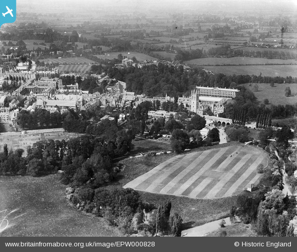
EPW000828 ENGLAND (1920). Magdalen College area, Oxford, 1920
© Copyright OpenStreetMap contributors and licensed by the OpenStreetMap Foundation. 2026. Cartography is licensed as CC BY-SA.
Nearby Images (18)
EPW000828

EAW003129

EAW045707

EPW000844

EAW045720

EPW000822

EAW049093

EAW031683

EPW052772

EAW049089

EAW047928

EPW052770

EPW000825

EAW014892

EAW049088

EPW052776

EAW018726

EAW003604

Details
| Title | [EPW000828] Magdalen College area, Oxford, 1920 |
| Reference | EPW000828 |
| Date | May-1920 |
| Link | |
| Place name | OXFORD |
| Parish | |
| District | |
| Country | ENGLAND |
| Easting / Northing | 452043, 206193 |
| Longitude / Latitude | -1.2460032207622, 51.751555972239 |
| National Grid Reference | SP520062 |