
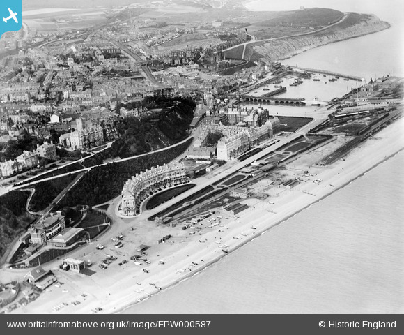
EPW000587 ENGLAND (1920). Marine Crescent and the harbour, Folkestone, from the south-west, 1920
© Copyright OpenStreetMap contributors and licensed by the OpenStreetMap Foundation. 2026. Cartography is licensed as CC BY-SA.
Nearby Images (18)
EPW000587

EPW042870

EAW002851

EPW019064

EAW024832

EPW000083

EPW009200

EPW009202

EPW035417

EPW000080

EAW002852

EAW024825

EPW009195

EPW042868

EPW000362

EAW002372

EPW009196

EPW019063

Details
| Title | [EPW000587] Marine Crescent and the harbour, Folkestone, from the south-west, 1920 |
| Reference | EPW000587 |
| Date | April-1920 |
| Link | |
| Place name | FOLKESTONE |
| Parish | FOLKESTONE |
| District | |
| Country | ENGLAND |
| Easting / Northing | 622955, 135667 |
| Longitude / Latitude | 1.1832524226933, 51.076408953177 |
| National Grid Reference | TR230357 |
Pins

Sara |
Friday 13th of June 2025 01:17:10 PM | |
|
Sara |
Saturday 4th of August 2018 08:32:13 AM | |
|
Sara |
Saturday 4th of August 2018 08:31:24 AM | |
|
Roscoe |
Saturday 21st of November 2015 09:03:54 PM | |
|
Roscoe |
Saturday 21st of November 2015 09:02:36 PM | |
|
Roscoe |
Saturday 21st of November 2015 09:01:50 PM | |
|
John Wass |
Saturday 5th of July 2014 12:04:50 PM |