
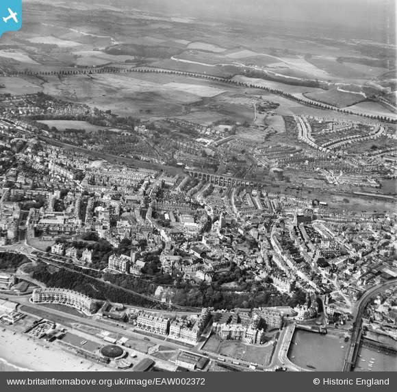
EAW002372 ENGLAND (1946). The town and Foord Viaduct, Folkestone, from the south-east, 1946
© Copyright OpenStreetMap contributors and licensed by the OpenStreetMap Foundation. 2026. Cartography is licensed as CC BY-SA.
Nearby Images (16)
EAW002372

EPW009196

EPW035417

EAW002852

EAW002373

EPW000355

EAW024832

EPW000083

EPW019065

EAW002853

EPW042870

EPW000587

EPW000372

EAW002851

EPW019064

EPW000080

Details
| Title | [EAW002372] The town and Foord Viaduct, Folkestone, from the south-east, 1946 |
| Reference | EAW002372 |
| Date | 9-September-1946 |
| Link | |
| Place name | FOLKESTONE |
| Parish | FOLKESTONE |
| District | |
| Country | ENGLAND |
| Easting / Northing | 623049, 135873 |
| Longitude / Latitude | 1.1847194026765, 51.078222151482 |
| National Grid Reference | TR230359 |
Pins

redmist |
Sunday 16th of February 2025 10:07:10 AM | |
|
redmist |
Sunday 16th of February 2025 09:45:50 AM | |
|
Kizle7 |
Friday 25th of August 2023 03:34:47 AM | |

Sparky |
Sunday 17th of September 2017 04:34:15 PM | |
|
Paolo |
Thursday 20th of August 2015 09:33:59 PM |