
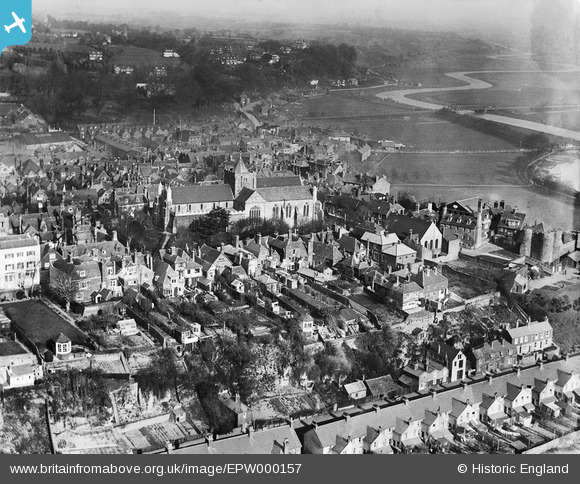
EPW000157 ENGLAND (1920). View of Rye and St Mary's Church, Rye, from the south, 1920
© Copyright OpenStreetMap contributors and licensed by the OpenStreetMap Foundation. 2026. Cartography is licensed as CC BY-SA.
Nearby Images (9)
EPW000157

EPW026242

EPW026239

EPW026245

EPW026238

EPW035363

EPW039359

EPW039360

EPW000129

Details
| Title | [EPW000157] View of Rye and St Mary's Church, Rye, from the south, 1920 |
| Reference | EPW000157 |
| Date | February-1920 |
| Link | |
| Place name | RYE |
| Parish | RYE |
| District | |
| Country | ENGLAND |
| Easting / Northing | 592175, 120202 |
| Longitude / Latitude | 0.73617754159412, 50.948623398253 |
| National Grid Reference | TQ922202 |
Pins

Class31 |
Thursday 24th of January 2013 10:01:40 PM |
User Comment Contributions

View of Rye Town from the south showing St Mary's Church, Town Salts, Rye Hill and Monkbretton bridge |

PaulS |
Thursday 6th of February 2014 01:13:18 PM |