
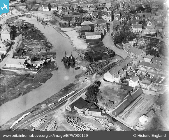
EPW000129 ENGLAND (1920). The Quay, Rye, 1920
© Copyright OpenStreetMap contributors and licensed by the OpenStreetMap Foundation. 2026. Cartography is licensed as CC BY-SA.
Nearby Images (15)
EPW000129

EAW035586

EPW039359

EAW035582

EAW035584

EAW035581

EAW035585

EAW035583

EAW035580

EAW035587

EPW035363

EPW035362

EPW000157

EPW026238

EPW026245

Details
| Title | [EPW000129] The Quay, Rye, 1920 |
| Reference | EPW000129 |
| Date | February-1920 |
| Link | |
| Place name | RYE |
| Parish | RYE |
| District | |
| Country | ENGLAND |
| Easting / Northing | 591927, 120134 |
| Longitude / Latitude | 0.73261498494015, 50.948095176201 |
| National Grid Reference | TQ919201 |
Pins
Be the first to add a comment to this image!
User Comment Contributions

The Quay, showing the Strand Quay and warehouses before the A259 |

PaulS |
Thursday 6th of February 2014 12:39:58 PM |