
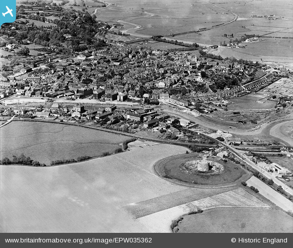
EPW035362 ENGLAND (1931). Martello Tower No 30 and the town, Rye, from the south-west, 1931
© Copyright OpenStreetMap contributors and licensed by the OpenStreetMap Foundation. 2026. Cartography is licensed as CC BY-SA.
Nearby Images (6)
EPW035362

EAW035585

EAW035581

EPW000129

EAW035586

EPW039359

Details
| Title | [EPW035362] Martello Tower No 30 and the town, Rye, from the south-west, 1931 |
| Reference | EPW035362 |
| Date | 25-May-1931 |
| Link | |
| Place name | RYE |
| Parish | RYE |
| District | |
| Country | ENGLAND |
| Easting / Northing | 591770, 119939 |
| Longitude / Latitude | 0.73027967456902, 50.946395718298 |
| National Grid Reference | TQ918199 |
Pins

glennhughz |
Wednesday 9th of April 2014 05:25:22 PM | |

Class31 |
Thursday 24th of January 2013 10:06:39 PM |
User Comment Contributions

Rye East Gate |

Alan McFaden |
Tuesday 26th of August 2014 12:15:45 PM |

Rye Old Bell PH |
Alan McFaden |
Tuesday 26th of August 2014 12:15:25 PM |

Rye Old Grammar Square |
Alan McFaden |
Tuesday 26th of August 2014 12:15:01 PM |

Rye |
Alan McFaden |
Tuesday 26th of August 2014 12:14:33 PM |

Rye |
Alan McFaden |
Tuesday 26th of August 2014 12:14:14 PM |