
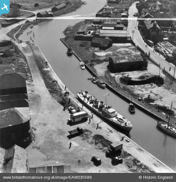
EAW035586 ENGLAND (1951). The Quay, Rye, 1951. This image has been produced from a print marked by Aerofilms Ltd for photo editing.
© Copyright OpenStreetMap contributors and licensed by the OpenStreetMap Foundation. 2026. Cartography is licensed as CC BY-SA.
Nearby Images (12)
EAW035586

EAW035581

EAW035584

EAW035582

EAW035583

EAW035580

EAW035587

EAW035585

EPW000129

EPW039359

EPW035362

EPW000128

Details
| Title | [EAW035586] The Quay, Rye, 1951. This image has been produced from a print marked by Aerofilms Ltd for photo editing. |
| Reference | EAW035586 |
| Date | 23-April-1951 |
| Link | |
| Place name | RYE |
| Parish | RYE |
| District | |
| Country | ENGLAND |
| Easting / Northing | 591870, 120172 |
| Longitude / Latitude | 0.73182444145241, 50.948455511101 |
| National Grid Reference | TQ919202 |
Pins
Be the first to add a comment to this image!