
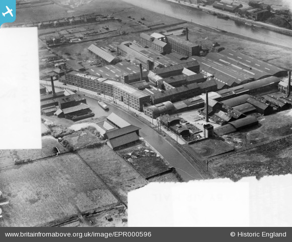
EPR000596 ENGLAND (1935). The Highfield Tannery, Runcorn, 1935. This image was marked by Aero Pictorial Ltd for photo editing.
© Copyright OpenStreetMap contributors and licensed by the OpenStreetMap Foundation. 2026. Cartography is licensed as CC BY-SA.
Nearby Images (7)
EPR000596

EPR000597

EPR000595

EPR000512A

EPR000513

EPR000598

EPR000594

Details
| Title | [EPR000596] The Highfield Tannery, Runcorn, 1935. This image was marked by Aero Pictorial Ltd for photo editing. |
| Reference | EPR000596 |
| Date | 10-May-1935 |
| Link | |
| Place name | RUNCORN |
| Parish | |
| District | |
| Country | ENGLAND |
| Easting / Northing | 352727, 382980 |
| Longitude / Latitude | -2.7100926981122, 53.341336684917 |
| National Grid Reference | SJ527830 |
Pins

Bottom Yard |
Wednesday 26th of December 2018 11:41:29 PM | |
|
Bottom Yard |
Wednesday 26th of December 2018 11:40:09 PM | |
|
david |
Sunday 19th of April 2015 06:51:22 AM | |
|
david |
Sunday 19th of April 2015 06:45:47 AM | |
|
david |
Sunday 19th of April 2015 06:34:24 AM | |
|
david |
Sunday 19th of April 2015 02:51:27 AM | |
|
david |
Sunday 19th of April 2015 02:49:55 AM |